
By Professor William B. Gould IV
By Professor William B. Gould IV |
| Map
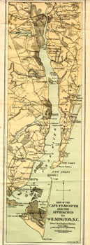
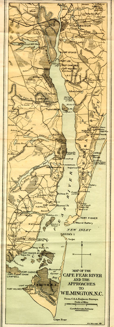
of the Cape Fear River. This map of the Cape Fear River as it flows from Wilmington to the Atlantic Ocean shows the route that WBG and seven other contrabands took the evening of September 21 as the made their escape from Wilmington. It took the men the entire night of Sept. 21-22 to proceed beyond the heavily guarded river and to reach the Atlantic in safety. On Sept. 22, the U.S.S. Cambridge and the U.S.S. State of Georgia, both part of the North Atlantic Blockading Squadron, spot the small boat off Fort Caswell. To view a close-up of the map, click here. ("Map of the Cape Fear River and Approaches to Wilmington, N.C." Official Records of the Union and Confederate Navies in the War of the Rebellion, Courtesy of New Hanover Public Library) |